How Drought Cycles - Create Fire Corridors - Across Continents

How Drought Cycles Create “Fire Corridors” Across Continents

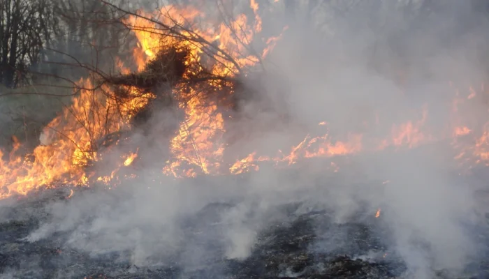
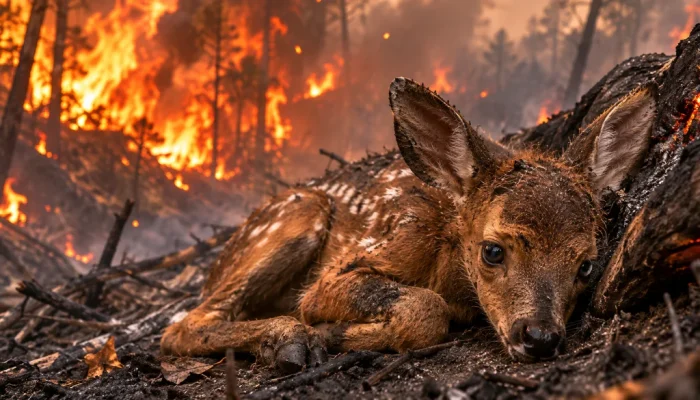
Wildfires are often described as isolated disasters, but some of the most dangerous fires develop within much larger landscapes where weather, vegetation, and drought conditions combine to make fire spread easier. These landscapes can create what researchers and fire specialists may describe as fire corridors: broad areas where dry vegetation, heat, wind, and other conditions can create pathways for wildfire to move across large distances. Understanding how these corridors develop is important because it shows that wildfire risk is not controlled by a single factor, such as a lack of rain, but by a chain of connected environmental changes that can build over weeks, months, or even years. By learning how drought affects vegetation, how compound fire weather develops, and how new technologies can improve wildfire detection, communities can become better prepared to prevent fires and respond to them before they grow into major disasters.

How Drought Changes the Landscape

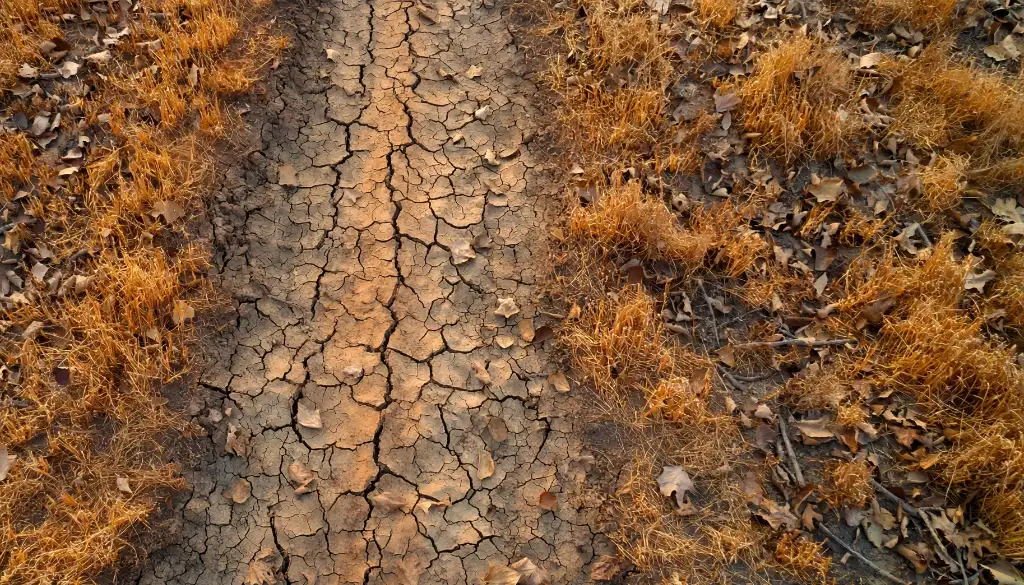
Drought is one of the most important factors in understanding wildfire risk, but it is important to think of drought as more than simply a long period without rain. A drought changes the condition of the entire landscape by reducing the amount of water available to soil, plants, trees, and other living organisms. As the landscape becomes drier, vegetation that was once difficult to burn can become highly available fuel, creating conditions in which a fire can start more easily and spread more quickly.

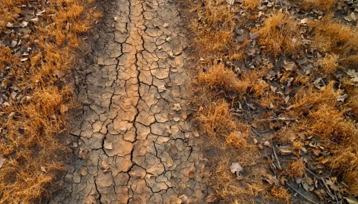
Plants naturally contain water, and that water helps prevent vegetation from drying out and burning rapidly. During drought, however, plants lose moisture through normal processes such as evaporation and transpiration while receiving less water from the soil. Grass can become dry and brittle, shrubs can lose moisture from their leaves and branches, and trees can experience increasing stress as their access to water declines. At the same time, dead leaves, fallen branches, dry grasses, and other plant material can accumulate on the ground, creating additional sources of fuel.

This is the basic drought–fuel connection. Drought does not simply make the ground dry; it can change the amount, structure, and moisture content of the material available to burn. When vegetation contains less moisture, less energy is required to dry it further and bring it to the point where it can ignite. Fine fuels such as grasses, leaves, and small branches can be especially important because they can dry quickly and respond rapidly to changes in weather.

The effects of drought can also extend across large areas. If a region experiences the same dry conditions for an extended period, vegetation across that region can become increasingly stressed at the same time. Instead of having small patches of dry vegetation separated by areas that are relatively moist, an entire landscape may begin to contain fuel that is capable of burning. This does not mean that every part of the landscape will burn, but it can increase the possibility that a fire will find continuous fuel once it starts.

The Drought–Fuel Connection

The relationship between drought and wildfire fuel is one of the most important ideas for understanding large fires. A landscape does not need to look completely dead to contain dangerous fuel. Even partially dried grass, shrubs, fallen vegetation, and weakened trees can contribute to fire spread, especially when weather conditions are hot, dry, and windy.

Drought can also affect forests in more complex ways. Trees under severe water stress may become less able to defend themselves against insects and diseases, and prolonged stress can contribute to tree death in some ecosystems. Dead trees and branches can then become additional fuel, although the effect varies greatly depending on the type of forest, the climate, and how recently the vegetation died.

Another important factor is fuel moisture, which describes how much water is contained within vegetation and other combustible material. Fire managers can use measurements of fuel moisture, weather, vegetation, and soil conditions to better understand how easily a landscape may burn. When fuel moisture becomes very low, vegetation can ignite and burn more readily, particularly when strong winds or high temperatures are present.

This explains why a drought can create wildfire conditions even before a fire begins. The drought is changing the landscape and preparing the fuel, while another event, such as lightning or human activity, may provide the ignition. In this way, wildfire risk can build quietly over time before becoming visible.

From Dry Landscapes to Fire Corridors

When large areas experience similar drying conditions, they can begin to function as connected pathways for wildfire spread. These areas can be thought of as fire corridors, although the term does not necessarily describe a permanent geographic feature. Instead, it can describe a landscape where the arrangement and condition of vegetation, combined with weather and terrain, make it easier for fire to move from one area to another.

Imagine a large region covered by grasslands, shrubs, forests, or a mixture of different vegetation types. Under normal conditions, some parts of the landscape may contain enough moisture to slow a fire, while other areas may have limited fuel. After a prolonged drought, however, more of the vegetation may become dry at the same time. If strong winds are also present, a fire can potentially move through these connected areas much more quickly.

Terrain plays an important role as well. Fire generally spreads more quickly uphill because flames and heat can preheat vegetation higher on the slope. Valleys, ridges, and other landforms can also influence wind patterns and the direction in which a fire moves. As a result, the same amount of dry vegetation can produce very different fire behavior depending on the shape of the landscape.

A fire corridor can therefore emerge from the interaction of several conditions rather than from drought alone. Dry vegetation provides fuel, terrain can influence the direction and speed of spread, and weather can determine how quickly that fuel loses moisture and burns. When these factors align across a large region, a relatively small ignition can potentially develop into a much larger event.

The concept is particularly useful because it shifts attention away from the idea that wildfires are always isolated incidents. A fire may begin in one location, but the conditions that allow it to spread may have been developing across an entire region for a long time.

Compound Fire Weather: When Multiple Extremes Align

One of the most important parts of understanding modern wildfire risk is recognizing compound fire weather. Wildfire conditions are not always caused by one extreme event. In some cases, several environmental extremes occur together or one after another, creating conditions that are much more dangerous than any single factor would suggest.

A landscape might already be extremely dry because of months of drought, for example, and then experience a sudden heatwave. At the same time, humidity may fall to unusually low levels, strong winds may develop, and dry thunderstorms may bring lightning without enough rainfall to significantly wet the ground. If the region also experienced heavy vegetation growth during an earlier wet period, there may be an unusually large amount of plant material available to burn.

This combination is important because each condition can reinforce the others.

Prolonged Drought

Prolonged drought is often the foundation of a compound wildfire event because it reduces moisture throughout the landscape. Soil becomes drier, vegetation becomes stressed, and dead plant material can become more flammable.

However, drought does not automatically mean that a major wildfire will occur. A dry landscape can remain unburned if there is no ignition or if weather conditions prevent a fire from spreading. Drought creates vulnerability, but it is only one part of the larger system.

A Sudden Heatwave

A heatwave can rapidly intensify conditions that have already been created by drought. Extremely high temperatures increase evaporation and can cause vegetation to lose moisture more quickly, particularly when the air is also dry.

This means that a landscape that is already close to a critical threshold can become much more flammable during a short period of extreme heat. A heatwave lasting only several days can therefore have a significant effect when it occurs after weeks or months of drought.

Very Low Humidity

Humidity describes the amount of water vapor in the air, and low humidity generally means that the atmosphere is very dry. When humidity is low, vegetation and other fuels can lose moisture to the surrounding air more easily.

This is particularly important for fine fuels such as dry grass and leaves, which can respond quickly to changes in atmospheric conditions. When these materials become extremely dry, they can ignite and burn rapidly, giving a fire the opportunity to move across the landscape before firefighters have time to contain it.

Strong Winds

Wind is another major factor because it can push flames into unburned vegetation and increase the rate at which a fire spreads. Strong winds can also carry burning embers away from the main fire, potentially creating new ignitions ahead of the fire front.

This can make wildfire behavior difficult to predict. A fire may appear to be moving in one direction, only for changes in wind speed or direction to alter its path. In extreme situations, embers can travel considerable distances and ignite vegetation in locations that appear to be separated from the main fire.

Dry Thunderstorms and Lightning

Thunderstorms can create a complicated wildfire threat. Rain from a storm can help reduce fire risk, but some thunderstorms produce lightning while delivering little rainfall to the ground. These are sometimes described as dry thunderstorms.

Lightning can ignite vegetation, and when the surrounding landscape is already extremely dry, the resulting fire may have favorable conditions for growth. The combination of a natural ignition source and dry fuel can therefore be especially dangerous.

Heavy Vegetation Growth After a Wet Period
The Connection Between Soil Moisture and Fire Risk

One of the more surprising connections between weather and wildfire is that a wet period can sometimes contribute to greater wildfire risk later.

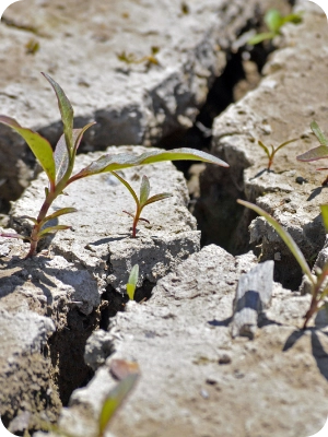
When an area receives abundant rainfall, grasses, shrubs, and other plants may grow rapidly. This creates a landscape with more vegetation than before. If a prolonged dry period follows, that vegetation can lose much of its moisture and become available fuel.

The sequence can therefore look like this: wet conditions encourage vegetation growth, followed by drought that dries the new growth, followed by heat and wind that increase the potential for rapid burning.

This does not mean that rainfall causes wildfires. Instead, it shows why wildfire risk can depend on the timing and sequence of weather conditions. A region that looks green and healthy during one season can contain a large amount of dry fuel during a later season.

Why Compound Extremes Matter

The greatest wildfire risks can occur when these factors reinforce each other. Drought reduces moisture, a heatwave increases drying, low humidity removes additional moisture from vegetation, strong winds accelerate fire spread, and lightning can provide an ignition source. Meanwhile, vegetation that grew during an earlier wet period may provide a large supply of fuel.

This is why it can be misleading to describe wildfire risk using a single variable. Rainfall matters, but so do temperature, humidity, wind, vegetation, terrain, and ignition sources. When several extremes happen together, the resulting conditions can be much more dangerous than any one of them would be on its own.

Why Fire Corridors Can Cross Large Regions

Wildfire risk can extend far beyond the location where a fire eventually begins because weather systems and drought conditions can affect very large areas. A single region can contain hundreds or thousands of square kilometers of vegetation experiencing similar drying conditions, particularly during a widespread drought.

Large-scale weather patterns can also create periods of persistent heat or dryness across entire regions. When these conditions continue for weeks or months, vegetation in many different ecosystems can become increasingly dry at the same time.

This helps explain how fire corridors can appear across large landscapes. The corridor does not need to be a straight line, and it does not have to remain in the same location every year. Instead, it can emerge where fuel, weather, and terrain combine to create favorable conditions for fire spread.

The same basic process can occur in very different environments. Mediterranean climates, grasslands, forests, shrublands, and other ecosystems have different types of vegetation, but all can contain combustible material that becomes more available when moisture levels fall.

The details vary from continent to continent, which is why wildfire science must consider local ecosystems and climate patterns. A wildfire in a dry grassland will not behave exactly like a wildfire in a dense forest, and a fire in a mountainous region will respond differently to one in a flat landscape. Even so, the broader relationship between moisture, fuel, weather, and fire behavior can be observed across many parts of the world.

The Influence of Climate and Changing Weather Patterns

Climate is another important part of the wildfire discussion because it influences the background conditions under which drought and extreme weather occur. A warmer atmosphere can increase evaporation and raise the amount of moisture that the atmosphere can hold, which can contribute to drying under some conditions.

Changes in precipitation patterns can also influence wildfire risk. What matters is not only how much rain falls over an entire year, but also when that rain falls and how it is distributed. A region could receive significant rainfall during one period and then experience a long dry season during which vegetation dries out.

The timing of wet and dry periods can therefore be extremely important. A wet period may encourage vegetation growth, while a later drought may turn that vegetation into additional fuel. At the same time, repeated heatwaves can accelerate drying and make recovery from drought more difficult.

It is important, however, not to treat climate as a simple explanation for every wildfire. Wildfires have many causes, and an individual fire still requires an ignition source. Human activity, lightning, infrastructure failures, land management, vegetation conditions, and local weather can all influence whether a fire starts and how it develops.

Climate and weather can shape the conditions that make fire more likely, but they do not determine the outcome of every individual ignition. Understanding that distinction is important for having a more accurate conversation about wildfire risk.

Wildfire Prevention: What Can Be Done?

Wildfire prevention begins with reducing the chances that a fire will start and limiting the amount of fuel available around vulnerable communities. Prevention cannot eliminate wildfire risk completely, particularly in ecosystems where fire is a natural part of the environment, but it can reduce the likelihood that an ignition will become a destructive event.

One important part of prevention is responsible behavior around sources of ignition. Outdoor fires, machinery, vehicles, electrical equipment, and other human activities can all create sparks or flames. Following local fire restrictions and taking extra care during periods of extreme fire danger can help reduce preventable ignitions.

Vegetation management is another important tool. In areas close to homes and other buildings, reducing excessive vegetation and creating defensible space can give firefighters more opportunities to protect structures. The exact approach depends on the local ecosystem and regulations, but the general goal is to reduce the amount of easily ignited material immediately around buildings.

Community planning also matters. Local authorities can use wildfire risk assessments to identify areas that may be vulnerable and improve evacuation routes, emergency communication systems, and public education. People who understand wildfire risks are more likely to recognize warnings and take action when conditions become dangerous.

Drones for Wildfire Detection and Monitoring
Drones and Airborne Thermal Imaging

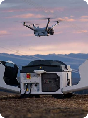
Technology is becoming increasingly important in wildfire prevention and response, and drones are one example of how aerial tools can improve the way landscapes are monitored.

Drones can provide aerial views of forests, grasslands, remote areas, and other locations that may be difficult or dangerous for people to inspect directly. Depending on the equipment being used, drones can help monitor vegetation, investigate smoke reports, observe fire perimeters, and provide emergency teams with updated information about conditions on the ground.

During an active wildfire, this information can be particularly useful because fire conditions can change rapidly. Aerial imagery may help emergency teams understand where the fire is moving and which areas may require additional attention.

Drones can also be useful before a fire begins. Regular monitoring can help identify changes in vegetation, fuel conditions, or areas where management may be needed. Used correctly, drones can become another layer in a larger wildfire monitoring system.

They are not a replacement for firefighters, aircraft, satellites, weather stations, or other forms of monitoring. Instead, their value comes from combining information from multiple sources to create a clearer picture of what is happening across a landscape.

AI-Powered Cameras and Early Detection

Another emerging technology is the use of AI-powered cameras to detect potential wildfires. These systems can continuously monitor landscapes and use computer vision to identify patterns that may indicate smoke or fire.

Traditional wildfire detection can depend on people seeing smoke, reporting a fire, or monitoring data from satellites and other systems. AI-powered camera networks offer another approach by watching specific areas continuously and automatically analyzing what they see.

Early detection can be extremely important because the size of a wildfire can change quickly, particularly when weather conditions are hot, dry, and windy. Finding a small fire early can give emergency teams more time to investigate the ignition, deploy resources, and potentially prevent the fire from becoming much larger.

AI systems are not perfect, and smoke-like objects, dust, fog, clouds, or other visual conditions can create false alarms. For that reason, automated detection works best when it supports trained human operators and other sources of information rather than replacing human decision-making.

As these systems improve, the combination of cameras, drones, satellites, weather information, and AI analysis could provide communities with a more detailed picture of changing wildfire conditions. The goal is not simply to detect fires faster, but to understand risk earlier and give people more time to respond.

Conclusion: Learning to Live With Wildfire Risk

Wildfires are shaped by a complex relationship between weather, vegetation, terrain, ignition sources, and human activity. Drought is an important part of that relationship because it can remove moisture from soil and vegetation, turning living plants and dead material into more available fuel. However, drought alone does not explain the most dangerous wildfire events.

The greatest risks can develop when several conditions occur together. A prolonged drought can prepare the landscape, while a sudden heatwave, very low humidity, strong winds, dry thunderstorms, and lightning can create the conditions for rapid fire development. At the same time, heavy vegetation growth from an earlier wet period can provide an unexpected supply of fuel once that vegetation dries.

When these factors overlap across large landscapes, they can create what we can understand as fire corridors, where connected areas of dry vegetation and favorable weather allow fires to spread more easily. These corridors are not necessarily permanent features, and they can change as weather, vegetation, and land conditions change.

Understanding these patterns is valuable because prevention begins with knowledge. Communities can reduce some ignition risks, manage vegetation, improve emergency planning, and use technologies such as drones and AI-powered cameras to detect potential fires earlier. Individuals can also learn about local fire restrictions, wildfire warnings, evacuation plans, and the conditions that make fires more dangerous.

Wildfire will remain a natural part of many ecosystems, and completely eliminating fire is neither possible nor always desirable. The larger goal is to understand when and where wildfire can become dangerous, reduce preventable ignitions, protect vulnerable communities, and respond quickly when fires begin. The more we learn about drought, fuel, compound fire weather, and changing environmental conditions, the better prepared we can be to live with wildfire risk.

Picture of SmokeD

SmokeD

Our mission is to increase the level of safety of people and animals living in high-risk areas, which are particularly exposed to fires. By implementing our system, we protect you, your facilities, and the nature that surrounds us. We are happy to cooperate on projects that have a huge positive impact on our planet.

Share post on: