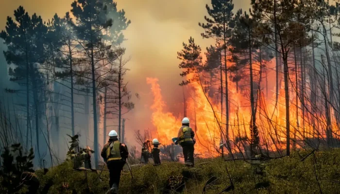
Wildfires are among the most destructive natural disasters that people face today, and scientists, policymakers, and local communities all share the growing concern about how to better understand, predict, and prevent them, because the danger of a wildfire spreading through dry forests, grasslands, or shrublands is not just about flames and smoke but about the conditions that make those fires more likely to start and more difficult to control, and at the center of this discussion lies the concept of fire risk, which is influenced by a wide range of factors that include temperature, wind, vegetation, and one especially important yet often overlooked element, soil moisture.
Soil moisture is the water held in the soil that plants use to grow, and while that may sound like a simple thing, it plays a major role in whether landscapes remain green, damp, and resistant to flames or whether they turn into dry, brittle, and combustible fuel that can ignite and spread fire quickly, which means that paying attention to soil moisture is not just important for farmers or gardeners but for anyone concerned about the increasing severity and frequency of wildfires across the globe. In this article, we will explore what soil moisture is, how it is measured, how it connects to fire behavior, how monitoring systems use it to improve forecasts, and why communities should consider it as part of long-term fire management strategies.
.
What is Soil Moisture?
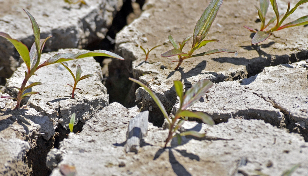
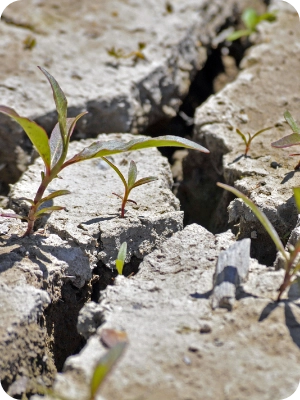
Soil moisture is the amount of water stored in the soil at any given time, and it comes from rainfall, irrigation, and melting snow, moving into the ground and filling the small pores between soil particles where roots can draw it in. When the soil is moist, plants grow well, the ecosystem stays balanced, and the land resists burning, but when the soil dries out, plants suffer stress, and the landscape becomes more vulnerable to ignition.
Measuring soil moisture is not as straightforward as simply looking at the surface of the ground, because soil can appear dry on top while still holding water deeper down, so scientists use several methods to get accurate readings. On the ground, they insert probes that measure electrical resistance or how quickly heat moves through the soil, since both depend on how much water is present. In addition, satellites now provide large-scale estimates by detecting subtle changes in the Earth’s surface that correspond to water content, and advanced computer models combine weather data, vegetation types, and terrain information to simulate soil conditions across entire regions. These measurements are crucial because soil moisture levels can change quickly depending on temperature, rainfall, and plant use, meaning that continuous monitoring is needed to keep track of whether an area is becoming more or less vulnerable to fire.
Soil moisture also varies with the seasons, since in many climates winter and spring bring higher levels of water in the soil due to rainfall or snowmelt, while summer often dries out the land as heat and evaporation increase, and regional differences add another layer of complexity. For example, Mediterranean climates like California see wet winters and very dry summers, which create a yearly cycle of growth followed by drying that fuels wildfires, while tropical regions may experience different patterns tied to monsoon seasons, and deserts hold very little soil water year-round, making them highly prone to fire once enough vegetation grows.
.
The Connection Between Soil Moisture and Fire Risk
To understand the link between soil moisture and fire risk, it is helpful to picture a piece of land after weeks of rain compared to the same land after months of drought. When the soil is wet, plants are lush and green, the air feels humid, and the ground itself resists burning, but when the soil is dry, plants turn brown, leaves fall, branches snap easily, and the ground cover becomes brittle fuel ready to ignite with even a small spark. Soil moisture, in other words, acts as a buffer that slows down or speeds up the transition from healthy vegetation to fire-prone material.
When drought occurs, the lack of rainfall not only removes surface water but also reduces the amount stored in deeper layers of the soil, and this long-term depletion creates stress on trees, grasses, and shrubs. Vegetation under water stress loses its ability to regulate temperature, drops leaves, and eventually dies, leaving behind dead biomass that can serve as excellent fire fuel. Moreover, dry soil itself can become extremely hot during heat waves, creating conditions where even underground organic matter, such as peat, becomes combustible.
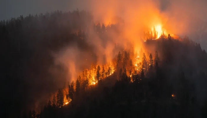
Examples of this connection can be seen around the world. In California, several major fire seasons have followed years of low precipitation that left soils parched and vegetation dry. In Australia, the “Black Summer” fires of 2019–2020 occurred after record-breaking drought, when soil water storage reached critically low levels. In the Amazon, deforestation combined with dry seasons lowered soil moisture to levels that encouraged massive fires, even though rainforests are not naturally fire-adapted ecosystems. These cases show that monitoring soil water is not just a scientific exercise but a real-world necessity for anticipating when and where fire hazards are rising.
.
How Soil Moisture Influences Vegetation and Fuel Loads
Plants depend on soil moisture for survival, because their roots draw water from the ground to support photosynthesis, nutrient transport, and structural growth, and when soil water is plentiful, plants stay hydrated, flexible, and less likely to burn. When soil moisture drops, however, plants begin to close their stomata to conserve water, slowing down growth and reducing their green, moist tissues. If drought persists, leaves dry out, stems weaken, and eventually whole plants may die, adding to the buildup of dry material on the forest floor.
This process transforms a living, green landscape into one where dry grass, fallen needles, brittle shrubs, and dead branches accumulate, creating what fire managers call “fuel loads.” The higher the fuel load, the more energy a wildfire can release, and the faster it can spread, particularly if winds are strong and temperatures are high. In this way, soil moisture directly affects not only whether plants are alive or dead but also how much potential fuel exists in a given area, and how flammable that fuel is.
In grasslands, low soil moisture leads to rapid drying of grasses, which can ignite easily and spread flames quickly across large distances. In forests, dry soil stresses trees, leading to insect infestations, disease, and mortality, which further add to fuel accumulation. Even in agricultural lands, soil moisture matters because crops under drought stress are more likely to become dry biomass after harvest, increasing the chance of field fires. The interaction between soil moisture and vegetation is therefore a crucial driver of fire dynamics across many types of ecosystems.
.
Soil Moisture Monitoring for Fire Risk Management
Because soil moisture is such a strong indicator of landscape dryness, scientists and fire managers have increasingly turned to monitoring systems that track it in real time. These systems use a combination of satellite data, ground-based instruments, and weather models to estimate how much water is present in soils across entire regions, and this information feeds into fire prediction models that estimate the likelihood of ignition and spread.
Satellites like NASA’s Soil Moisture Active Passive (SMAP) mission provide global maps of soil water at shallow depths, while other instruments measure vegetation greenness and surface temperatures to cross-check conditions. Ground sensors installed by research networks offer more precise measurements at specific locations, and weather forecasts help project whether soils will become wetter or drier in the coming days and weeks. By blending these sources, fire managers can identify areas where soils are critically dry, issue warnings, and allocate firefighting resources more effectively.
One practical example is the United States Drought Monitor, which combines soil data with rainfall and vegetation information to create maps of drought severity. These maps help predict regions at higher risk of wildfire, guiding both emergency services and local communities. In Australia, similar monitoring tools are used to assess seasonal outlooks, determining whether a coming summer is likely to bring severe fire danger. The more accurate these tools become, the better they can support decisions about land closures, controlled burns, and resource planning.
.
Mitigation and Preparedness Strategies
Understanding soil moisture also shapes how communities prepare for and reduce wildfire damage. Land management practices that take soil water into account can reduce vulnerability by controlling vegetation growth, managing fuel loads, and planning burns at safer times. For example, controlled or prescribed burning is often carried out when soil moisture levels are still moderate, ensuring that the fire consumes surface fuels without spreading uncontrollably into the canopy or underground.
Policymakers and emergency agencies can also use soil moisture data to design long-term strategies, such as deciding where to restrict development, how to allocate water for irrigation, or when to enforce seasonal fire bans. Farmers and landowners can use local soil monitoring tools to decide when to graze livestock or when to clear excess dry vegetation. Communities can incorporate soil moisture forecasts into fire education programs, helping residents understand why certain times of the year pose greater hazards and how they can prepare by clearing defensible space around homes or by planning evacuation routes.
The role of soil moisture in fire preparedness extends even further into climate change adaptation. As global warming alters precipitation patterns and increases evaporation rates, many regions will face deeper and more frequent droughts, reducing soil water availability and making landscapes more fire-prone. By incorporating soil moisture into climate models, scientists can anticipate which areas are likely to see heightened wildfire activity in the coming decades, offering critical guidance for governments, conservationists, and disaster response teams.
.
Conclusion
The relationship between soil water and wildfire is complex yet deeply important, and by looking closely at soil moisture we gain a powerful tool for understanding and reducing fire risk. Soil moisture influences whether plants remain healthy or turn into fuel, determines how quickly a landscape dries out during drought, and shapes the intensity and spread of wildfires once they start. Monitoring systems now allow us to track soil conditions across large areas, and this knowledge can be applied to fire forecasting, land management, and community preparedness.
As climate change increases the likelihood of extreme heat and prolonged drought, paying attention to soil water becomes even more urgent, because the choices we make today about monitoring, planning, and adaptation will determine how vulnerable our landscapes are tomorrow. Soil moisture may not always be visible to the naked eye, but it is one of the most critical hidden factors shaping the safety and resilience of our ecosystems, and by understanding it better, we can take meaningful steps toward reducing the devastating impacts of wildfires.
For readers interested in exploring how broader environmental changes connect to increasing wildfire danger, see the related article Climate Change Wildfires: Understanding the Growing Threat, which provides further context on how rising global temperatures and shifting weather patterns are intensifying wildfire events worldwide.