Wildfires are becoming stronger, larger, and harder to control every year, and as communities expand into fire-prone areas, the danger to human life, homes, and natural habitats continues to grow. Scientists, governments, and firefighters are searching for new tools that can help them prepare before the flames even begin, and one of the most powerful tools they now rely on is artificial intelligence. With the help of advanced technologies such as satellite imagery, weather data, infrared cameras, drones, and automated detection algorithms, AI systems are now being trained to predict where the Next Wildfire Hotspot is most likely to appear. By combining different data sources and analyzing them in real time, AI not only improves early warning systems but also helps reduce false alarms and increases the accuracy of fire alerts, giving responders more time to act.
Satellite Imagery: The First Layer of Prediction
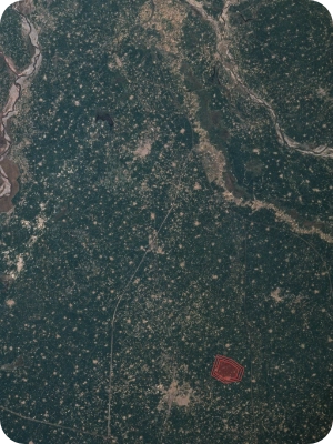
When researchers try to predict where the Next Wildfire Hotspot might develop, one of the first resources they turn to is satellite imagery. Satellites orbiting high above the Earth are constantly scanning the land below with powerful sensors that can capture data across many wavelengths of light. This is known as multispectral or hyperspectral imaging, and it allows experts to see changes in the environment that would be invisible to the human eye. For example, satellite images can show how much moisture vegetation contains, whether grasses or shrubs are drying out, and how much heat is being radiated from the surface of the ground.
These details are crucial for understanding the conditions that make fires more likely. Dry vegetation acts like fuel, and when a spark or lightning strike occurs, the fire can spread much faster if the plants and soil are already parched. By monitoring satellite data every day, AI systems can track these changes and generate risk maps that highlight areas most likely to ignite. This means firefighters and land managers can allocate resources more effectively, cutting firebreaks, conducting controlled burns, or placing equipment closer to areas of concern. Satellites are also useful for tracking how existing fires grow, but their predictive power makes them an essential first step in locating the zones that might become the next disaster.
Another advantage of satellite technology is its global perspective. Since satellites orbit the Earth, they can cover large regions that would be impossible for ground-based teams to monitor all the time. This wide coverage ensures that no matter where a wildfire threat emerges, from the remote forests of Canada to the dry grasslands of Australia, AI has a steady stream of information to assess.
Weather Data and Sensor Networks
Predicting fire risk is not only about what is happening on the ground but also about what is happening in the atmosphere. Weather is one of the most important factors in determining whether a small spark will turn into a catastrophic blaze. High winds can carry embers across long distances, extremely low humidity dries out plants and soil, and heat waves increase the overall risk of ignition.
AI systems collect vast amounts of weather data from satellites, local weather stations, and even specialized fire-monitoring sensors. They then analyze patterns that humans might miss. For instance, an AI model can process years of historical climate data, compare it to current conditions, and highlight which regions are following the same dangerous pattern that preceded earlier fires. This allows researchers to forecast when and where fires are most likely to occur.
Sensor networks on the ground add another layer of detail. These sensors can measure air temperature, soil moisture, and wind speed directly in fire-prone areas, sending the information back to AI platforms in real time. By combining weather forecasts with sensor data, AI creates highly detailed predictions that point to the Next Wildfire Hotspot with surprising accuracy. Fire agencies can then move equipment, warn communities, or even temporarily close trails and parks to keep people safe before the flames ever appear.
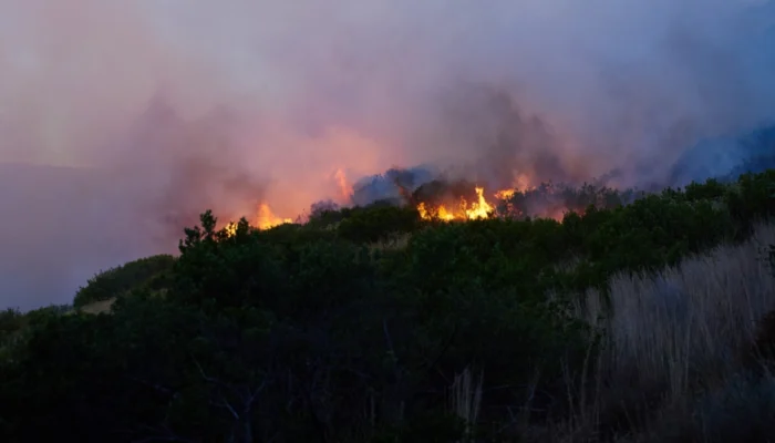
Real-Time Infrared Cameras for Wildfire Detection
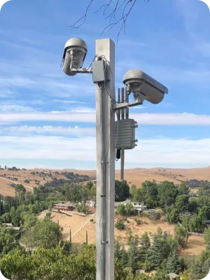
While satellites and weather data help with prediction, actual detection of fires requires different tools. Many fire-prone areas are now equipped with fixed infrared cameras that scan the landscape 24 hours a day. Unlike regular cameras that capture visible light, infrared cameras detect heat. This allows them to spot even the faintest heat signatures, such as a small brush fire smoldering before it spreads.
AI plays an important role here because not every heat signature indicates a wildfire. A warm rock surface, a vehicle, or even sunlight reflecting off metal could trigger a false alarm if humans were monitoring the cameras alone. AI algorithms, however, can analyze heat data with much greater precision. They look at patterns of movement, the intensity of the heat, and how it changes over time. A true fire tends to flicker, spread, and grow hotter, while other heat sources remain steady. By recognizing these differences, AI can quickly flag potential fires while ignoring harmless signals.
The use of infrared cameras is particularly important at night when visibility is low. Traditional fire lookouts may not spot a fire until the flames are already large, but infrared cameras can detect them when they are still small and manageable. This early detection can save valuable time, allowing firefighters to arrive on the scene before the situation becomes uncontrollable.
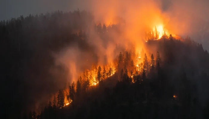
Drones and Airborne Thermal Imaging
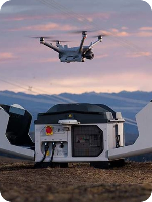
Even though fixed cameras and satellites cover wide areas, there are still many places that are difficult to monitor, such as steep mountains, dense forests, or remote wilderness zones. To solve this problem, drones equipped with thermal imaging cameras are now being deployed. These drones can fly over dangerous terrain, capturing high-resolution images of the land below. Since they are mobile, they can be directed to specific locations where conditions suggest a higher risk or where smoke has been spotted from afar.
Thermal imaging from drones works in a similar way to infrared cameras but with even greater detail. Drones can hover close to the ground, scan specific regions, and transmit live data to AI systems. By analyzing the heat maps created by these flights, AI can identify potential fire outbreaks before they are visible to the naked eye.
In addition to drones, manned aircraft are also used for airborne thermal imaging. These planes can cover larger areas in a single flight and provide wide-scale monitoring during high-risk fire seasons. Together, drones and airplanes create a flexible network that fills the gaps left by satellites and ground-based cameras, ensuring that even the hardest-to-reach areas are monitored for signs of the next fire.
Automated Detection Algorithms: Cutting Down False Alarms
One of the biggest challenges in wildfire detection is separating real fires from false alarms. Smoke from barbecues, heat from industrial equipment, or even natural reflections can all look like potential fires to the untrained eye. This is where AI’s automated detection algorithms truly shine.
These algorithms are designed to process massive amounts of visual and thermal data, examining every detail of heat patterns. They do not simply register whether an area is hot but analyze how the brightness changes over time, whether there is flickering movement, and whether the heat is spreading outward. By combining these factors, the system can determine whether the signal represents a real fire or something harmless.
This reduces the number of false alarms that emergency services receive, which is important because every unnecessary deployment wastes valuable time and resources. With more accurate alerts, firefighters can focus on real threats, often reaching the fire site much earlier than they would have with traditional methods.
As these algorithms continue to improve, they are expected to become even more accurate, learning from past mistakes and successes. This adaptive ability ensures that predictions about the Next Wildfire Hotspot become sharper over time, offering a safer future for communities and ecosystems at risk.
Conclusion: The Future of Predicting Wildfire Hotspots
The combination of satellite imagery, weather data, real-time infrared cameras, drones, and advanced algorithms shows how far technology has come in the battle against wildfires. By blending these tools together, AI creates a powerful network of detection and prediction systems that can not only forecast where the Next Wildfire Hotspot might appear but also confirm fire outbreaks with greater speed and precision than ever before.
As climate change continues to make extreme weather events more common, the role of AI in wildfire prediction will only grow in importance. Communities will depend on these systems to prepare evacuation routes, strengthen firebreaks, and manage land more effectively. Firefighters will rely on accurate alerts to reach fires while they are still manageable, saving lives, property, and natural landscapes.
The future may bring even more advanced AI tools, such as predictive models that combine social data with environmental signals or robotic systems that can assist in firefighting directly. But at the heart of all these innovations is one clear goal: to identify and prepare for the Next Wildfire Hotspot before the flames erupt, turning potential tragedy into manageable risk.